Discover Elon Musk’s Gigabay plan to build 1000 Starships per year in massive factories in Texas and Florida—redefining space travel and Mars colonization.
Elon Musk’s Gigabay: The World’s Largest Rocket Factory to Build 1000 Starships a Year: Introduction
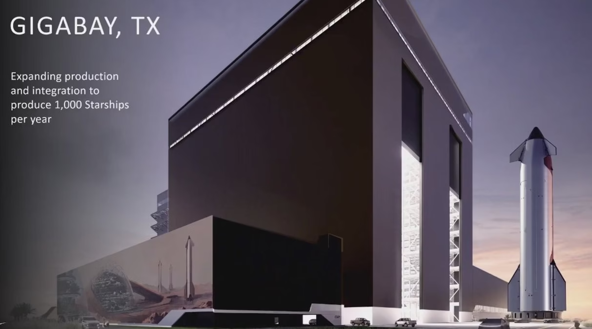
Elon Musk has once again shocked the world with his next revolutionary infrastructure project: the Gigabay. Designed to mass-produce 1,000 Starships annually, Gigabay represents the next step in scaling up interplanetary transport, placing humanity one step closer to becoming a multiplanetary species. This groundbreaking initiative involves the construction of two enormous manufacturing facilities—one in Texas and another in Florida—that will each be among the largest structures on Earth.
Starship, which is already the most powerful rocket ever built, will now be produced on a scale comparable to that of commercial airliners, with the Gigabay operating like an aerospace assembly line of the future. In this article, we explore everything we know so far about Elon Musk’s Gigabay—from its purpose, size, and technological innovations, to its potential impact on space travel, global logistics, and the aerospace industry.
What Is Elon Musk’s Gigabay?
The Gigabay is a newly announced, massive rocket production facility conceived by Elon Musk and SpaceX. The goal is to produce 1,000 Starships every year, essentially building one Starship every day. Gigabay is named in the same spirit as Musk’s previous large-scale factories like the Gigafactory, but this time, the focus is not on electric vehicles or batteries—it’s on mass-producing orbital-class reusable rockets.
Each Gigabay will be a specialized manufacturing hub with massive hangars, vertical integration, advanced robotics, and launch support capabilities. According to Musk, two Gigabays are being constructed initially: one at Starbase, Texas, and another at Cape Canaveral, Florida.
Why Build Gigabay? The Need for Mass Starship Production
Musk’s long-term vision for SpaceX is to make life multiplanetary. For this vision to become a reality, humanity needs a transport system that is:
- Fully reusable
- Inexpensive per launch
- Rapidly scalable
- Capable of carrying large payloads and hundreds of passengers
Starship, with its massive capacity and full reusability, is already proving its potential to fulfill these requirements. However, a single Starship isn’t enough. To build a sustainable Mars colony, launch satellite mega-constellations, or provide ultra-fast point-to-point travel on Earth, thousands of Starships will be needed.
That’s where the Gigabay comes in. This facility will allow Musk to industrialize rocket manufacturing in a way never before attempted.
The Scale: One of the Largest Structures on Earth
Gigabay is not just ambitious in purpose—it’s monumental in scale.
- Size: Each Gigabay will reportedly span multiple million square feet, rivaling or surpassing the footprint of Boeing’s Everett factory and Tesla’s Gigafactories.
- Height: The production bays must accommodate the Starship, which stands nearly 120 meters tall—much taller than a Boeing 747.
- Output: 1,000 Starships per year equates to nearly three Starships per day, making Gigabay the largest rocket assembly operation in human history.
Location: Texas and Florida
Starbase, Texas
Already home to the earliest Starship prototypes, Starbase in Boca Chica will house the first Gigabay. This location is already equipped with testing and launch infrastructure, making it ideal for integrating production with live launches.
Cape Canaveral, Florida
Florida’s Space Coast is another strategic location for the second Gigabay. With easy access to orbital launch corridors and decades of aerospace experience, Cape Canaveral provides logistical and technical advantages for high-frequency Starship launches.
Starship: Bigger Than a 747
Each Starship is far larger than any commercial airplane in service today.
- Height: 120 meters
- Diameter: 9 meters
- Payload Capacity: Up to 150 metric tons to low Earth orbit
- Passenger Capacity: Potentially over 100 humans per flight
By comparison, a Boeing 747 is only 70 meters long and has a payload of about 100 tons. The sheer scale of Starship makes Gigabay not just a rocket factory—it’s a megastructure built to handle spacecraft the size of buildings.
Gigabay and the New Era of Aerospace Manufacturing
Elon Musk’s Gigabay introduces a paradigm shift in how rockets are designed, built, and launched:
1. Mass Production
Traditional rockets are custom-built, expensive, and produced in small numbers. Gigabay flips this model by adopting automated, high-volume production lines, reducing costs through economies of scale.
2. Full Reusability
Starships are designed to be fully reusable, enabling rapid turnaround times. Gigabay’s manufacturing system will support reusability by including maintenance, repair, and refurbishment zones under the same roof.
3. Vertical Integration
Like Tesla’s Gigafactories, Gigabay will vertically integrate nearly every aspect of production—from engines and structural components to avionics and tanks—on-site.
4. Digital Twin and AI Integration
Future Gigabays may use digital twins, machine learning, and AI for optimizing part performance, predicting component wear, and accelerating design improvements.
Strategic Goals and Missions
Elon Musk has outlined several key missions that Gigabay will support:
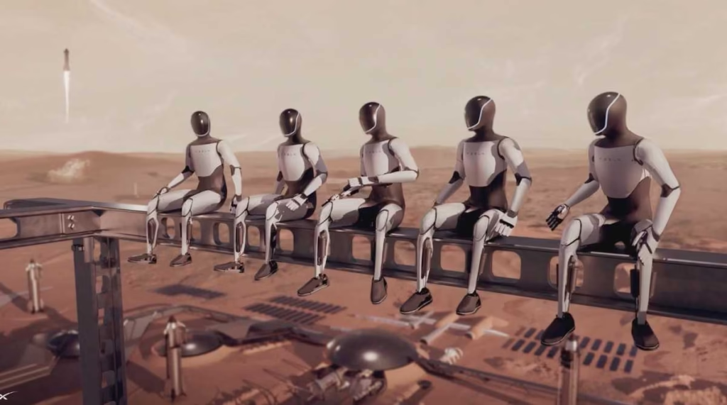
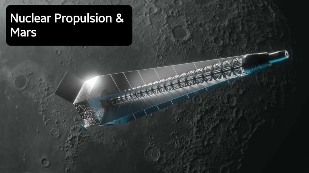
1. Mars Colonization
To send 1 million people to Mars, SpaceX needs thousands of Starships. Gigabay makes this vision feasible by offering the industrial capacity to produce spacecraft at scale.
2. Starlink Satellite Deployment
Starlink needs thousands of satellites to provide high-speed internet globally. A high Starship launch cadence will drastically cut the cost per launch, enabling faster deployment of mega-constellations.
3. Lunar Missions and NASA Partnerships
Starship is set to serve NASA’s Artemis program, which aims to return humans to the Moon. Gigabay will ensure a consistent supply of lunar-capable Starships.
4. Earth-to-Earth Transport
Musk envisions Starship being used for suborbital Earth-to-Earth flights, carrying passengers across the planet in under an hour. This demands an aircraft-level production rate, which Gigabay enables.
Environmental and Economic Impacts
Sustainability
Although space launches are energy-intensive, SpaceX aims to make Gigabay operations sustainable. This includes:
- On-site solar and battery installations
- Methane sourced from sustainable methods (including carbon capture)
- Reduced emissions through reusability
Job Creation
Each Gigabay is expected to create thousands of high-tech jobs, from aerospace engineering to AI-driven robotics to advanced logistics. The regional economic benefits will mirror those of Tesla’s Gigafactories.
Global Logistics Revolution
Starship’s scale and cost-effectiveness, backed by Gigabay’s industrial output, could revolutionize how cargo is moved globally—potentially creating space cargo logistics as a new economic sector.
Challenges Ahead
No revolutionary project is without obstacles. Gigabay faces several technical, political, and economic challenges:
- Regulatory Hurdles: Building mega-factories and launching rockets daily will require close collaboration with FAA and global regulators.
- Supply Chain Complexity: Producing 1,000 Starships annually means massive amounts of stainless steel, Raptor engines, avionics, and propellants.
- Technological Scalability: High-reliability at mass production levels is uncharted territory in aerospace.
However, if any team can overcome these issues, it’s SpaceX under Musk’s leadership—already known for rewriting the rules of rocket science.
Conclusion: A New Industrial Age for Space
Elon Musk’s Gigabay is not just a factory—it’s a launchpad into the next age of human civilization. By building Starships as quickly and efficiently as cars or planes, Gigabay enables humanity to reach beyond Earth with confidence, speed, and scale.
If successful, the Gigabay will mark the beginning of the industrialization of space, offering new opportunities in exploration, science, commerce, and defense. It has the potential to reduce launch costs by orders of magnitude, stimulate global innovation, and create a future where Mars, the Moon, and even interplanetary travel are within reach of everyday humans.
Musk’s Gigabay stands as a bold symbol of what’s possible when vision, capital, and technology converge with a mission to shape the future.
ISRO Gujarat Space Facility: What Is India’s ₹10,000 Cr Project At Ahmedabad?
Frequently Asked Questions (FAQs) About Elon Musk’s Gigabay
Q1. What is Elon Musk’s Gigabay?
A: Elon Musk’s Gigabay is a new type of ultra-large manufacturing facility created by SpaceX to mass-produce 1,000 Starships per year. These Gigabays are designed to be the largest rocket factories in the world, capable of building, assembling, and launching Starships at an industrial scale.
Q2. Why is it called “Gigabay”?
A: The name “Gigabay” follows the naming convention of Musk’s other massive factories, such as the Gigafactory. In this case, “Gigabay” refers to a gigantic rocket assembly bay, emphasizing the massive scale and purpose-built nature of the structure to accommodate large rockets like Starship.
Q3. How many Gigabays are being built?
A: Elon Musk has announced plans to build two Gigabays initially: one at Starbase in Texas and another at Cape Canaveral, Florida. Both locations are strategically positioned near existing launch infrastructure.
Q4. How many Starships will each Gigabay produce per year?
A: Each Gigabay is expected to produce up to 1,000 Starships per year, meaning nearly three Starships per day across both locations once fully operational.
Q5. Why does SpaceX need 1,000 Starships annually?
A: The goal is to support Mars colonization, satellite deployment (such as the Starlink network), lunar missions, and even Earth-to-Earth space travel. Mass production makes Starship flights more affordable and reliable, enabling frequent launches for both cargo and passengers.
Q6. How big is a Starship compared to an airplane?
A: A single Starship is approximately 120 meters (394 feet) tall—much taller than a Boeing 747, which is around 70 meters long. Starship is also capable of carrying significantly more payload—up to 150 metric tons to low Earth orbit.
Q7. How big will the Gigabays be?
A: Each Gigabay will span millions of square feet, with massive vertical assembly bays, robotic lines, engine testing areas, and potentially even launch pads. They will be among the largest enclosed industrial buildings on Earth.
Q8. What technologies will be used inside Gigabay?
A: Gigabay will use advanced robotics, automated production lines, AI-driven diagnostics, vertical integration, and real-time data systems to monitor and manage every phase of rocket construction and testing.
Q9. Where are the Elon Musk’s Gigabay sites located?
A:
- Texas Gigabay: Located at Starbase, near Boca Chica, where SpaceX currently launches and tests Starship.
- Florida Gigabay: Located at Cape Canaveral, near NASA’s Kennedy Space Center and other commercial launch infrastructure.
Q10. What economic benefits will Gigabay bring?
A: Each Gigabay is expected to create thousands of high-tech and skilled jobs, stimulate local economies, and generate business for a wide range of suppliers, contractors, and logistics providers. It also positions the U.S. as a leader in next-generation space manufacturing.
Q11. How will Gigabay affect space travel costs?
A: Gigabay’s mass production model will drastically reduce the cost per launch, making it economically viable to use Starship for routine space transport, deep space exploration, satellite deployments, and even cargo shipments around Earth.
Q12. Will the Gigabays support NASA and government missions?
A: Yes, SpaceX’s Gigabays will likely play a central role in building Starships for NASA’s Artemis Moon missions, lunar cargo, and possibly even military or defense-related space infrastructure.
Q13. When will the Gigabays become operational?
A: Construction has already begun at Starbase, and planning is underway for Cape Canaveral. While no exact completion date has been announced, Elon Musk aims to begin high-volume production in the next few years, starting around 2026 or earlier.
Q14. What makes Gigabay different from traditional rocket factories?
A: Traditional rocket factories produce a few rockets a year at high cost. Gigabay is designed like an automotive production plant—fast, modular, and scalable—able to output daily spacecraft at lower costs using assembly line principles and advanced automation.
Q15. How does Gigabay help in colonizing Mars?
A: Colonizing Mars requires hundreds or thousands of spacecraft for cargo, supplies, and human transport. Gigabay allows for the mass manufacture of Starships, making it possible to establish and maintain sustainable off-Earth colonies through frequent, low-cost launches.